Sunday, April 7, 2013

Lower Lena Lake

Lena Lake is a 2 part hike.  The first part is a day hike to Lower Lena Lake.  It's a little over 3 miles one way (according to the book) to the first lake.  The second part is Upper Lena Lake which is about 7 miles one way to the second lake.  Today's hike was to Lower Lena.  

It took almost 2 hours to drive to Hamma Hamma, the town where Lena Lake is located.  We didn't get on the road until after 10am.  It rained the whole way there, which is exactly what we were expecting, and prepared for.  We arrived at the trail head just before noon and got into our rain gear and off we went.

Lena Lake Trail Head
We weren't on the trail 5 minutes when the switchbacks started.  Oh my gosh, these where horrible.  There is some serious elevation gain right off the bat.  Back and forth back and forth on and on.  But at least there was lots to look at.  At at the beginning the trail was very well maintained.

Nice railing
But that nice well maintained trail didn't last long (don't worry, we'll get to that real soon).  First I have to show you the "trail love" that I found.  It seems like there are lots of hearts on the trail, if you just look for them.  I think of it as the trail giving me a little love along the way.  This was my favorite one that I saw on this hike (sorry it's a little blurry):

Trail Love
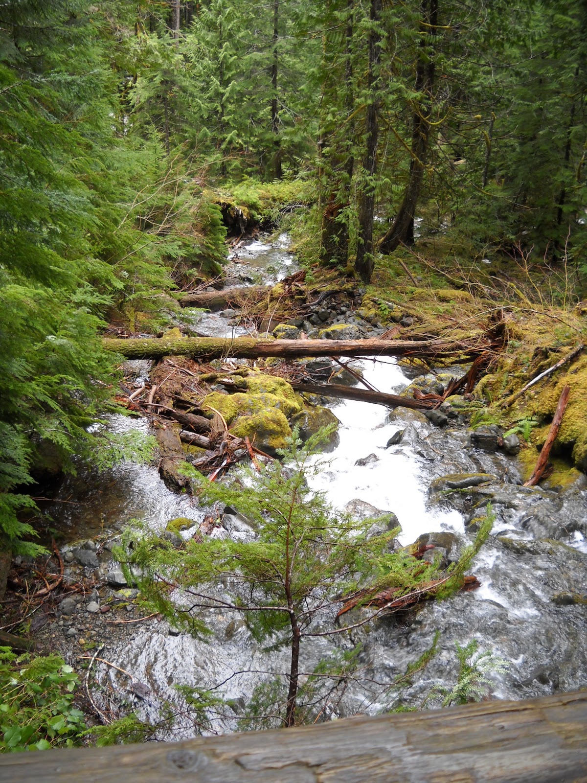
This trail had a lot of water on it and all around it.  I was in heaven.  For me the sound of moving water is so relaxing and I was hearing it the entire hike.  This is one of my two favorite photos from this hike.  I'm pretty sure it's going to end up in a frame on the wall.  Please click on it so you can see the full size image.

Snow Run Off
Our first encounter of "water on the trail" started early in the hike.  Before we were even out of the switchbacks we were dealing with little rivers that were cutting through the trail.

Leonard trying not to get wet
I just knew that this trail was going to kick my butt, it was the perfect combination to land me flat on my backside, but some how I managed to beat it this time.  I definitely stumbled a couple times and slipped a little, but each time I was able to recover.

As I was hiking along I found this beautiful gem that made me think of Linda, I know how much she loves green and this little mossy green stream whispered her name.  (I tend to think of her a lot when I'm hiking).

For Linda
This is my other favorite picture.  I think that this one is so pretty.  I like the way the moving water was captured in a blur and everything around it is so still.  I think it's well composed and definitely frame worthy.

Hike to Lena Lake
One really super cool thing about this hike is Lena Creek.  It's actually a pretty good sized creek that is very fast moving and can be heard during most of the hike to Lower Lena.  When you actually cross the creek for the first time this is what you see:
Lena Creek  looking uphill
First let me say, this picture does nothing for the breath taking amazement you will get standing in this very spot.  I could sit here for hours day dreaming.  I could tell this was a place of power.  I could feel the energy.  These are boulders.  Some 20 or 30 feet tall.  They were pushed into this place by an earthquake hundreds of years ago.  The creek is subterranean here but you can still hear it rushing along just on the other side of these boulders.  This is what it looks like with my back to the spot above:

Lena Creek  looking downhill

It isn't nearly as impressive, but still very breath taking.

Just past this spot is the first bridge.  It passes over Lena Creek but I believe it was subterranean here as well, unfortunately I can't recall.  It was a very interesting bridge though.  It's only wide enough for 1 person and has a fun little turn at the other end.  I just love how rustic it is!

Bridge over Lena Creek

Speaking of boulders.  As we got closer to the lake we came up on this one.  I'm glad I got Leonard in there so you can really see how huge this thing was.  Of course it set our minds to thinking about how long it had been there and when it might be due for it's next movement.  That kind of thinking leads to all sorts of places.
Huge Boulder
The next part of the hike was the scariest part for me.  I'm so disappointed in the pictures that I took of this area because it doesn't look scary at all.  But I assure you, it was!  Water was rushing down the side of the mountain very fast and the only place it had to go was right on the trail and then on down the mountain on the other side of the trail.  Once the water hit the trail it made a river about 6 feet wide that ran over a bunch of rocks on the trail. It was fairly deep, at least above boot level.  There were some rocks sticking up to use for traversing but they were mossy and slick as well as a log at the edge of the trail which could also be used for traversing, also very slick.  I wasn't sure how I was going to get across without slipping and/or falling in and getting soaked and/or hurt LOL.  Leonard went first and talked me across and held my hand as soon as I was in arm's reach.  Here's the water coming down the mountain:

That's a lot of water
Water on the Trail
As if all this craziness wasn't enough... next up was the snow!  Fortunately there was only one small place where the snow was on the trail but there was lots in the shady spots on the mountain.

SNOW!
The second bridge was over Lena Creek again, but this time she showed herself in all her beauty.  This waterfall is pretty high and really loud.  I even took a little video so you could be there with me.

Looking up Lena Creek

Looking down Lena Creek

Here we are at the creek

And here's the little video I made (it's only a few seconds)


Just on the other side of the creek was a sign.  Just ahead there would be a fork that would head straight uphill to Upper Lena Lake.  Something to look forward to for another time.

I'm pooped
As you can see, we don't have our rain gear on.  Funny thing.  As soon as we got on the trail the rain stopped. It didn't rain a drop the entire time we were on the trail  It kept getting dark and threatened to rain and there were several times we thought we were going to have to turn back because it sure felt like we walked more than 3 miles and we weren't there yet and it was getting darker and darker.  At one point Leonard said that if the trail didn't start heading toward the lake soon then we would need to turn back so we wouldn't end up walking in the dark.  It was only a few minutes after he said those words that we rounded a corner and here's what we saw:

Lower Lena Lake
Finally!  The prize.  We decided to drop our packs and scout around a little bit to see if it's a place we would like to come back to camp.  There were only a few good spots, but the lake was really high and made us wonder if there are more spots that are just under water right now.  We could clearly see small trees that were sticking up through the water and trees don't normally grow in lakes LOL.  We decided that we would definitely like to come back.  It's a nice hike and there is plenty more exploring to do.

Down by the lake there were some amazing views.  Here's my Pano:
Lower Lena Lake

Taken with my phone's camera


Now to rest a bit.  It got pretty cold by the lake.  See the snow on the other side?  We decided to put on our rain jackets for a little extra warmth while we were resting.  They were perfect, they added a nice thin layer that didn't make us too hot but kept the chill off.

We spent about half an hour at the lake, scouting around, pottying, eating and drinking and of course, my signature photo:
My tired feet at Lower Lena Lake
The return trip wasn't too bad.  Even the scary part that had me so tripped up on the way up was a breeze.  I was definitely tired.  The app I got for my phone said the total trip was 8.5 miles.  I don't know how accurate it is, it felt more like 8.5 miles than 6.5 miles.  I know we didn't scout around for 2 miles, so I'm really not sure where that app picked up the extra 2 miles.  Or maybe it was actually correct and the book is wrong, trails, do change...

I was happy I didn't get the swelling in my hands this time.  The only difference I noted was that I went potty twice on this trip and it wasn't quite as long as the last one.  The bottoms of my feet were sure tender though.  The ball of my right foot is naturally sensitive due to whatever malfunction I have going on in there, and the hike really aggravated it and the 2 toes after my big toe.  I also got a bruise on my left leg where the top of my boot was rubbing on it.  My left ankle was still a little touchy from last week so I wore my boot a teensy bit looser than I normally like to have them to relieve the pain in my ankle but that made it just loose enough to rub.  Other than that... all is well.

Trip Stats:
Driving: 1 hour 45 minutes each way
Hiking: 4 hours 30 minutes
Hiking Distance: 6.5 miles
Rating: Moderate
Elevation Gain: 1250 feet
       

Sunday, March 31, 2013

Dry Creek Trail

Dry Creek Trail was a very fun (but very difficult) hike.  It took us 2 hours to get there and we were an hour and a half later getting on the road than we planned to be, but now we know, it takes us 2 hours to get packed, eat, make any pre-trip stops and get on the road.  A lesson learned.

This time we both had Day Packs.  I bought a second one just like mine only in black for Leonard.  Leonard says that if I'm going to hike the AT I need to train like I'm going to hike it.  Before our first day hike he insisted I know the 10 Essentials, which took a little bit, but I do know them by heart now:

  1. Shelter
  2. Sun Protection
  3. Navigation
  4. Food
  5. Water
  6. Tools
  7. Light
  8. Fire Starter
  9. Appropriate Weather Gear
  10. First Aid
With the exception of a tent (since we don't have one) we bring the 10 Essentials every time.  So... in my pack was Sun Screen, Map was in my pocket and a Compass on a lanyard around my neck, Trail Mix, 48 oz. of water, a flashlight, a rain jacket and sweat pants (I wore my capri pants this time since the day started out warm and sunny).  In his pack was Turkey Jerky, 48 oz. of water, a knife that has a fire starter built in, a flashlight, a rain jacket, sweat pants and a first aid kit.  We didn't weigh our packs this time, but I'm pretty sure they were less than 12 pounds.

The trail head was 64 miles away but the geography of it all made the drive very long.  After the first 20 minutes the entire trip is a 2 lane road that twists and turns along the Hood Canal through teeny tiny towns.  The speed limit is only 40 most of the way.  The last 5 miles are dirt road.  Didn't see that coming.  And I don't have an off road vehicle.  So that was about 10 miles per hour.

Dry Creek Trail starts out at the end of Lake Cushman where the snow run off is filling the lake.  This time of year the lake is fairly barren and tree stumps can be seen sticking up.  As the snow melts and the lake fills up those stumps disappear.  My pictures don't do it justice, but these stumps are probably bigger around than I am tall!

This is looking toward the lake, where the snow is heading to-
Lake Cushman
This is where the snow is coming from-
Snow Run Off
These pictures where taken from a bridge that crosses over the lake.  According to our guide book (published in 2008) it said that the trail is open year around, however when we got to this bridge there was a closed gate, so we parked the car on the side of the dirt road and walked across the bridge.

Here we are on the bridge:
Ready to get started- Wow!  It was sunny.

It was a bit of a walk just to get to the trail head but once there we found yet another closed gate... sure didn't feel open, but we walked around it and headed on in.

The beginning of the trail passes by several private homes.  These homes appeared to be vacant, as if they were summer/vacation houses.  There was no vehicular access to them and no sign of life (or electricity) and they all had their own little out house.  I saw this one and thought of Aunt Linda:
Cabin in the woods at Lake Cushman
Of course Leonard and I thought it would be A-MAZING to have a little place like this to get away to.  No driveway, no electricity, no running water, you hike in and hike out.  Yep.  I'm down with that!

After we passed several of these little places we came to... A Trail Registry!  This was my first hike that had one, I was so stoked I forgot to take a picture.  But it was there!  I put our names in and there was a place to check out and leave comments when we came back out, which we did remember to do.  I commented that it was "a great practice hike" and wanted to put that it was part of my AT training but there was no room.

This way to the Trail

The trail was marked in the beginning because of the private property but as it progressed there were times we had to look for other signs that we were on the trail.  Because it was so early in the season there hasn't been any trail maintenance yet this year.  There were quite a few downed trees we had to go over or under.  I don't see a trail here, do you?  It's there... just gotta find it.
WTT?  (Where's The Trail)

After the Private Property things started getting serious right away, but first we passed a lovely little "Hiker's Shower".  The cold snow run off felt pretty good already.  The water was coming down pretty good and showered the trail.
Hiker's Shower

There were lots of places along the trail where the run off was running right along the trail, even over it in some places.  There were places we had to cross over rocks that had water flowing under them and places where we just had to get our boots wet.  I would imagine that later in the season those places get much deeper.
Runoff along the trail

Runoff crossing the trail

In the Pacific Northwest the woods are full of these giant ferns.  They're beautiful and pictures just don't do them justice.  It's hard to tell, but this fern was probably 5 feet wide.
Giant Fern
In most places the trail was merely a foot path.  It reminded me of some of the pictures I've seen of the AT where it meanders through a wide open space with a trail just wide enough for one.  I like it that way.  It's nice to be with some one and know that they're there, but it's also nice to be able to just be in your head or be focused on the task at hand- putting one foot in front of the other.  It's these little foot paths that really allow you to hike your own hike.
Dry Creek Trail

It was an excruciating climb.   800 feet of elevation gain in 1 mile!  I know that I will see greater gains on the AT, but for my out of shape body that was torture.  I don't know how many times I had to stop and take a break just to breathe, but I do know it was a LOT.  Sometimes the distance between stops was so short I could actually see the previous place I stopped from the place I was currently stopped.  My heart and lungs are so out of shape.  After the last hike I threatened myself with a cardio regime that I never started... after this hike I know I have to start it.  

After a mile of what felt like straight up the trail leveled out and that was my favorite part.  It was cool and shaded and beautiful.  And then we hit snow!  That's right, snow.  The trail was covered in snow and we couldn't see it at all.  We nearly turned back several times then a few feet ahead we'd pick up the trail again. And we could hear the roaring (not dry) Dry Creek up ahead so we pushed through it.  The snow started out small and looking back it was funny because we took pictures standing by these teensy patches of snow-
Leonard standing by the first snow spotting

Me standing by the first snow spotting
A little ways down the trail there was a little more snow-
More Snow
And then it got serious-
Snow covering the trail, again- WTT?
This is where I ended up in the mud.  Fortunately it didn't go over the top of my boot but my entire boot was definitely submerged.  I was pissed.
The water IS the trail

Finally we made it to the end of the trail (the 3.5 mile mark, still have to turn around and go back).  How do I know it was the end of the trail?  I wasn't crossing THIS:
Dry Creek
Apparently in the summer the creek dries up because there is no more snow runoff and you can cross the creek bed to continue on for an over nighter.  The guidebook says that going any further would be too long for a day hike.  And I couldn't agree more.  The guidebook recommended grabbing a seat on a rock, enjoying lunch and heading back at this point.  As it were, all but one rock was covered in snow!  We stripped off our packs, ate some turkey jerky and trail mix, went potty and reapplied sunscreen (I've worked hard to get my creamy white complexion) and took my Signature Picture-
My tired feet at Dry Creek (see the snow on the side?)
We only spent about 10 minutes at the creek.  There wasn't any place to relax and we didn't want our muscles to cool down and not be able to move again, so off we went.  It didn't take long for me to realize I couldn't see... I didn't have my glasses.  I couldn't remember taking them off.  I started to panic and Leonard remembered that I took them off to put on sunscreen.  We went back and had too look a little, they blended into the ground very well.  I was so thankful that I noticed before we were back down that steep incline.  They would have stayed behind if that were the case.

The return trip was treacherous.  We didn't make very good time at all.  We had to move very carefully and intentionally to make sure we didn't slip or fall.  There were lots of roots and rocks to keep us focused.  My legs shook the whole way, they felt like jello and my knees kept trying to lock, refusing to take another step.  We were both wore out.  The sun was moving to across the sky, I was feeling the pressure to keep moving.  Even my fingers hurt.  When I noticed my sore fingers and looked at them I realized they were swollen up like balloons.  You know those balloons clowns use to twist into little balloon animals?  THAT is what my fingers looked like.  It was a little scary.  I tried to drink even more water, I knew that the swelling was from water retention.  I was sweating like a pig and had only peed once the entire day but we'd almost drank all of our 96 oz. of water so I knew I wasn't truly dehydrated.  I think my body was just freaking out from sweating so much because normally... I don't sweat.  Ever.  Then the ankle started.  My left ankle was very slightly rubbing on my boot the entire time.  At the very end, after passing the trail registry the real pain started.  I think that my ankle was swelling a little bit too.  I couldn't take more than a few steps before I had to readjust my boot.  This went on several times and finally I loosened my boot and it went away.

We made it back in once piece, both of us exhausted and in pain, but I didn't complain and Leonard noticed.  He actually complimented me for toughing it out.

Trip Stats:
Driving: 2 hours each way
Hiking: 5 hours total
Hiking Distance: 7.2 miles
Rating: Moderately Difficult
Elevation Gain: 700 feet

Saturday, March 23, 2013

Green Mountain via Gold Creek Trail

Wow!!  What a day.  It was phenomenal.

We started on the trail at about 9:15am.  It was cold and overcast, just yuckie really.  I had on my wool socks and hiking boots, a pair of capris (in case I got hot) under sweat pants, a short sleeve shirt, a long sleeve shirt, a hoodie and gloves.

My day pack was bursting at the seems- both our jackets, 2 32 ounce water bottles full of water, 2 zip locks of trail mix and toilette paper (just in case).  I also had a compass on a lanyard, my phone in my pocket and my camera attached to my chest strap.

My super cute day pack filled to capcity
Leonard carried a little fannie pack with a first aid kit, flashlights, his phone, a map, a pocket knife (with a fire starter) and 2 16 ounce water bottles full of water.  I think we were pretty well prepared.

Right off the bat we came to a little bridge that had water rushing under it.  It was so pretty and I just love the sound of rushing water.
Water under the Bridge
This trail allows all sorts of people to enjoy it.  And we saw it all too (well almost).  There were horses, lots of hikers and mountain bikers.  Motor bikes are also allowed on this trail.  I didn't think to snap a picture of this guy on his horse until he'd already passed by.  He had a sweet dog with him too.  Dogs are allowed off leash here.  Sure made me want a big dog.
Cutie on a horse
A little further down the trail was more rushing water, but it sounded BIG, like a water fall!  I couldn't get close enough Leonard wouldn't let me it was too dangerous.  But Leonard went down to the water fall and took some pictures for me.  Isn't he sweet?
I LOVE water falls
Next up was another little bridge.  And more water.  There was a LOT of water in, on and around this trail.
Leonard crossing the 2nd bridge

More Water under the Bridge
Continuing on we came to a fork in the road.  Going forward led to who knows where (some sort of road, I think) and going left kept us on track.  I'm not really sure how this could be a road though, there's a pretty big gap there...
GM6 (whatever that means)
Oh you'll love this... I'm not sure what the deal is with the pattern on this leaf, but this is exactly how we found it, completely untouched.  We saw it on the way back and another one just like it a little further down.  Had I seen BOTH on the way up I probably would have considered it a sign LOL.  Leonard said it looked like a Tiki Mask.
Tiki Mask Leaf
This trail was a pretty good climb for me.  It was only an elevation gain of 1000 feet, but that seemed straight up.  I had to stop several times to try to catch my breath.  And it didn't take me long to loosen that chest strap.  I was a hurtin' puppy.  My chest felt trapped and I didn't feel like I could get a viable breath in.  It eased up after I released the strap though.  It definitely made the pack flop a little but it was SO worth it.  Breathing is really good.  I was actually kind of glad that Leonard went on with out me a little bit.  He never got out of shouting range, if he couldn't see me he would call to me and as long as I called back he was fine.  I hate feeling like I'm keeping some one from hiking at their own pace.  He's really good at not making me feel that way, I just bring it on myself.  There were several time where I had to remind myself that it was just walking, just putting 1 foot in front of the other, I do it all the time.  And there were MANY times Leonard asked me if I wanted to go back.  No way in hell I was quitting.
Straight up hill, water rushing down the trail and all
At one point we saw a spot where power lines came down out of seemingly nothing.  There was a bench there and we stopped for a few minutes.  Leonard said we were back in civilization because there were power lines LOL.  I suggested we Zip Line down and see where it goes.  He thinks I'm insane.
Can you see the power lines on the left side?
The vista couldn't come soon enough.  I was tripping over my own feet, couldn't breathe and the rocks were causing me to stumble.  Leonard called it the "damn woods" a few times and continually told me that "this blows" every time we rounded a corner and didn't come to the vista.  It was kind of funny.  I was having a rough time, but so was he.  That made me feel a little better.  And then finally... there it was!
This is a sign at the edge of the parking lot (yes you can actually drive here)
There was a parking area that is accessed from a side road open Spring, Summer and Fall, a place to hitch your horses, a picnic table and a privy.  On the way up I got to explain to Leonard what a privy is.  Heeeheee, I knew something he didn't.

Stinky privy and picnic table (why are they so close?)
But this wasn't the sweet spot.  The view point is another ten thousand miles away.  Okay, maybe it just felt that way.  We were tired.  I kept thinking- I came here to hike the Gold Creek Trail, I've done that, I don't care about the view!  But I didn't actually speak any of those words.  Onward and upward!
Sign leading up to the view point
It was not the best of days so we couldn't see far when we got there but I did manage to capture a decent panorama with my phone.  I LOVE that feature.  My regular camera has a panorama option as well but it's not as smooth and easy as my phone.
On a clear day you can see Seattle.  Not today.
And I've decided to start a tradition.  A signature photo...
My tired feet at the top
At the top we sat at one of the many picnic tables and ate some trail mix, talked about the hike, drank a bunch of water and enjoyed a little sunshine.  The return trip was super easy and only took about an hour and 15 minutes..  It was all down hill LOL.  I didn't have any big problems going down.  My feet hurt from stepping on so many rocks and my toes on my right foot really hurt, but that's from a non related issue.  I did find a little bit of "trail love" along the way.
Heart shaped rock

The entire round trip took about 3.5 hours.  Which was pretty good.  The guide book said 3 hours and rated it as moderate difficulty.  I figured that as out of shape as I was it would be a good 4 hour hike.  I think we can improve, but for a first hike I'm pretty happy.

But what made me even more happy was to get home, get out of those sweaty wet clothes, take a steamy hot shower and put on clean clothes.  Nope, I'm not a thru hiker just yet... LOL.

Monday, March 18, 2013

Gear Check

I was telling Leonard about the hike I want to do on Thursday.  I was asking what kind of gear I need for a 4-5 hour hike.  He started naming things off:

  • Rain Jacket
  • A little snack
  • A water bottle for each of us
WAIT!  Each of us?  Meaning he's going with me?  Didn't see that coming.  So we decided to make a run down to REI in Tacoma (about 45 minutes from here) and get a day pack.  We decided on the REI Flash 18 (in Titanium and Lime Spritz) because it can be turned into a stuff sack for when I hike the AT (totally HIS idea, he is coming around).


Sunday, March 17, 2013

Exhilarating

It really is!

Every day my desire to become a long distance thru hiker grows stronger.  Lastnight another peg was put in my wall to boost me up higher.  We went to my in-laws to watch soccer.  Leonard's dad is a real outdoors-man.  He's probably been climbing mountains since he came out of the womb.  He was involved in Olympic Mountain Rescue for years (since before I was born) and he teaches Mountaineering at the local community collage.  He really does know it all.  So I asked Leonard to help me get some dialog going with about hiking the AT.  Well... this is how it went:

Leonard: Hey dad, Carolyn has this crazy idea about hiking the AT and I want you to talk her out of it.
Dad: HAHAHAHAHAHAHAHA

Yep, that's how it went down.  Because my FIL (a very tall, fit athletic man) looks at me (a short fat girl) and thinks "yeah right".  After the laughter subsided it finally occured to him to ask why the AT when the PCT is in our back yard.  I proceeded to explain that the AT is easier than the PCT, shorter than the PCT and is always within a few miles of a town in case I freak out or need help.  His reply was "It's CROWDED!"  Yes, and another reason to make it my first trail- there will always be some one around to help me if I need it.  I can see it churning in his head- "she's actually put some thought into this ridiculous idea".  And he says "Take a backpacking class at the college".  Well, that would be great IF I HAD TIME AND MONEY!  You see, that was Leonard's suggestion.  Yes, I said Leonard, the man I'm married to who already knows we don't have the money and I don't have the time- work isn't going to let me have time off for any college courses, especially not backpacking!  SO I explain this to my FIL and then I tell him the same thing I told Leonard- "You know everything that they would teach me in the class, maybe you could teach me.  I could start coming over for a few hours on my days off and you could teach me everything I need to know!"

Dad: (Deer in headlights look)

Conversation is OVER.  LOL

We watched the game, it was fun and then Leonard was summonsed to work on their virus riddled computer.  I thought about how the hiking conversation (that lasted 4 seconds) transpired and resigned to figuring this out myself, obvioiusly FIL isn't taking me seriously.  After 3 hours I went to check on them and FIL hands me a book- Day Hike: Olympic Peninsula.   That's us, the Olympic Peninsula (well, almost us).  I got all giddy because with the book came an invitation- "Find one you want to do and I'll take you on it".  Wha wha WHAT?  Oh yeah, I'm stoked.  Before we left I gave him a hug, thanked him a million more times and told him that I WILL take him up on it.

After we got home the reality sunk in.  I've got to get in shape for this- this man is an icon and I can't be huffing and puffing and begging him to wait on me the whole time.  I've got to be able to keep up.  And what will we talk about?  And I don't have any gear, what does one bring on a 5 hour hike?  OMG I've never hiked for 5 hours.  CAN I hike for 5 hours?  I start spilling all of this to Leonard who emphasizes that his dad is old and not in great shape any more.  "Um yeah, that's the problem, he's 60 something, had cancer and multiple heart attacks and STILL in better shape than me.  THAT is why I'm freaking out"  LOL.  I told Leonard that I don't think his dad takes me seriously.  So Leonard gives me a few tips- read the book ASAP, get back with him ASAP and talk to him.  He said to tell him which books I've read and that I know I need to lose weight and get in shape before I hike the AT but ask what I can be doing right now to prepare.  It was the first time I felt like Leonard actually even remotely supported my cause.

Well, when it was time to go to bed I couldn't sleep so I cracked open the book.  It's a guidebook outlining some of the best day hikes in the area.  There are 2 that lead up Green Mountain which is only a few minutes from where we live.  One is 4.8 miles round trip- 3 hours and the other is 9.0 miles round trip- 5 hours, both gain 1200 feet in elevation.  Sounds like a starting point.  The forecast for Thursday is good and it's my first of 5 days off- I'm doing it!  Well, now I definitely couldn't sleep so I decided to actually start at the beginning of the book and read everything, starting with the acknowledgements.  Guess who's mentioned there- you got it, Brad Albro, my father in law!  All I could do was smile.  I'm a lucky girl.


Saturday, February 9, 2013

Seeking...

...a hiking partner for the Triple Crown!  That's right, I'm doing it.  I have my heart and head set on it and it's time to find some one else who's serious and wants to do it.  My time frame is about 5 years for the first one, most likely the AT.  At this point I'm very much a beginner, in fact I don't even own any gear, I've never had a pack on my back and haven't slept in a tent in 14 years.  I would like to hike with some one who at least has a clue, but probably not some one who's done the hike before.  I don't want to hike with some one who is a know it all, I think it would be fun to experience it together and learn along the way.  I'm not really sure where to look for this person, especially since I'm so incredibly anti-social... but as it is, I have nothing but time.